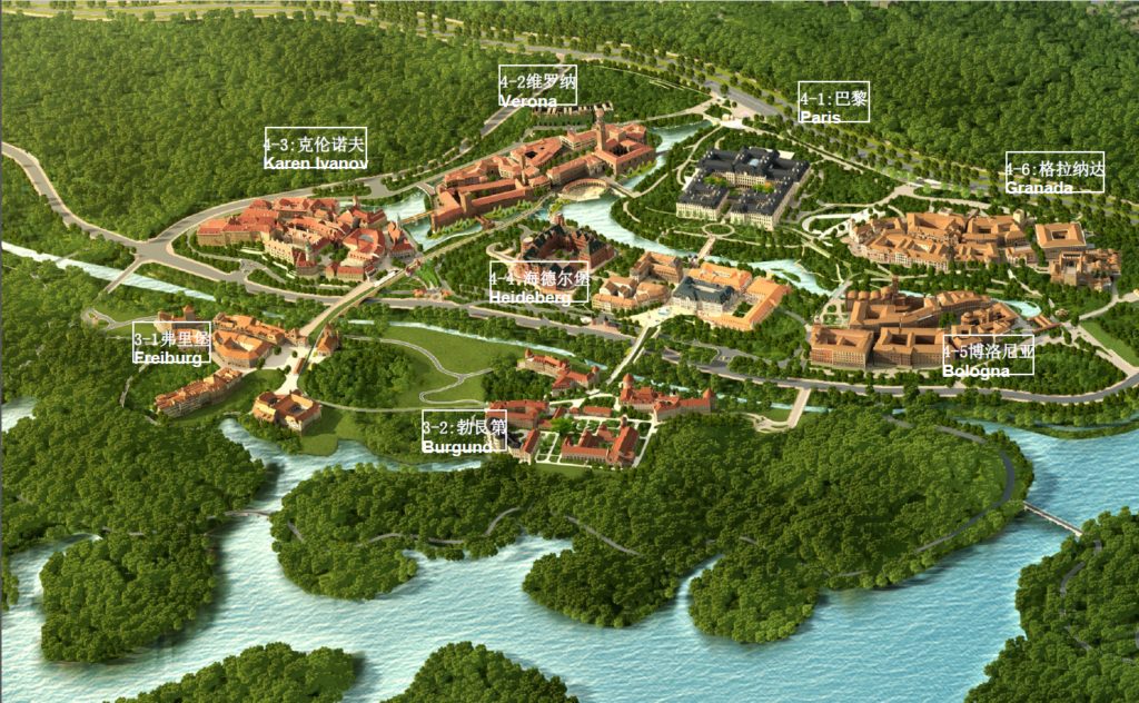
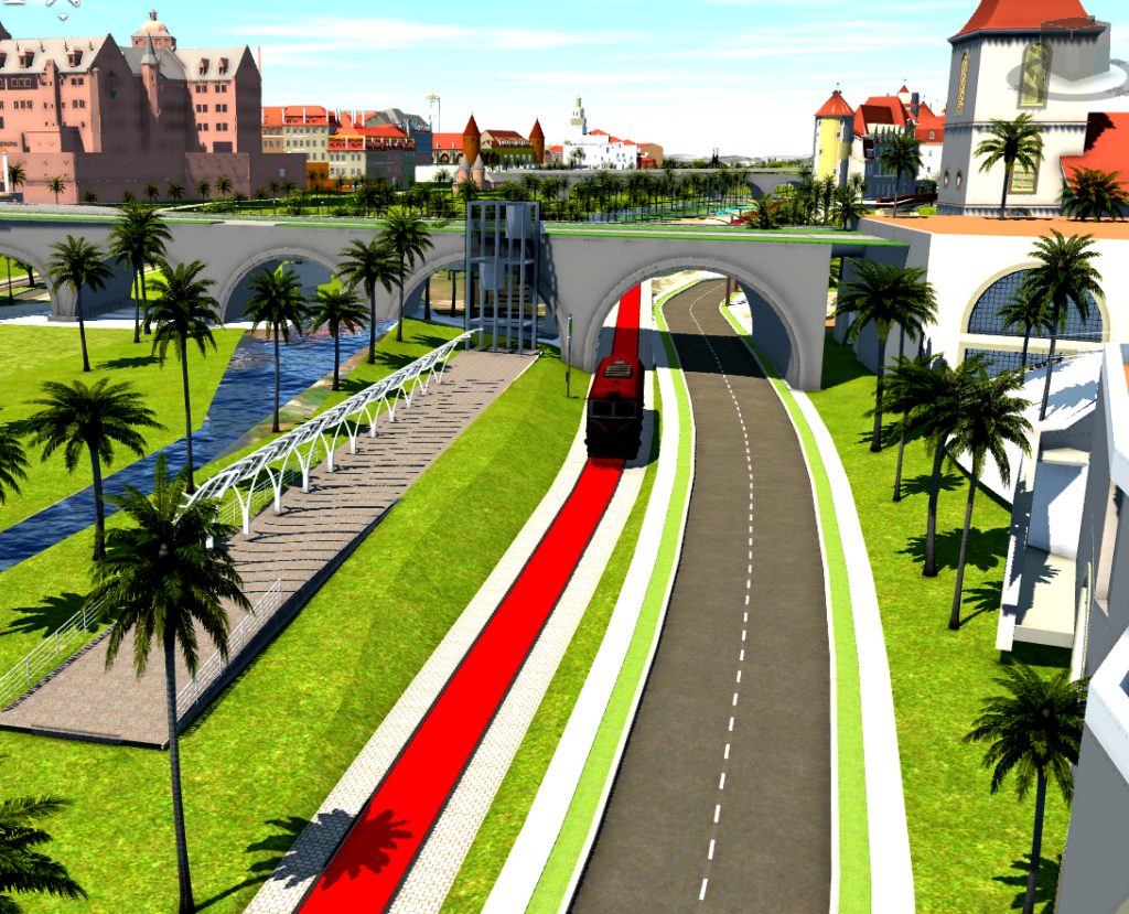
The Huawei Terminal new headquarters in Dongguan, Guangdong Province covers about an area of 12 square kilometers with a new tram design at about 13 kilometers. The project includes coordination of floodway, reservoir, bridge and mountains. Huawei’s Songshanhu base remodeled 12 classical cities or regions which are renowned in the world and deeply favored by people. A classical park is structured using the technique of group construction. And the landmark buildings, central squares, yards and the architectural complex echoing the periphery are linked up and blended together to express the artistic conception of “entirety”.
The project is reported directly on the BIM platform, eliminating the process of modeling personnel, reducing the waste of manpower and resources by nearly 50%.

Project goals
- Make the park beautiful, ecological and smart.
- Provide new methods for visualization, introduction, and communication.
- Design in a real, virtual environment to improve quality
- Integrate designs from different stakeholders
- Connect BIM with information systems and cloud for construction management, quality and safety.
Unique challenges
The project involves coordination of existing floodway, reservoir, bridge and mountains – all merging with the terminal project of tramline under construction. The owners have stringent requirements on bridge modeling and the landscape throughout the full line. These design demands were not met by traditional graphical design and visualization without interaction. This created some contention with the design team. As a result the team decided to adopt BIM for design and report to the owner directly.
Integrated design workflows
Advanced UAV was used to capture high level accuracy to save time in the field. After the team produced terrain models, point cloud model and 3D models. UAV was used throughout multiple stages of the design.
The team integrated GIS data into InfraWorks to simulate the real site which is the fundamental data for route design. Then detailed route design, plane and vertical property and cross sections were done in Civil 3D. The team then exported the route data into InfraWorks to review and optimize. During the preliminary design, they found that the tram routes crossing the mountain were not economical or comfortable and destroyed green vegetation and all were corrected. The integration of Civil3D and InfraWorks can make the design more accurate and reliable.
With subassembly composer, cross sections were modeled including ballast bed, side slope, side drainage, flood drainage, and fire pass along the flood drainage area. Revit was used for rebar drafting and Inventor was used to design the rail system. Because each design element could benefit from data in other design systems, the design workflow was more efficient.
BIM and GIS
With such a large, comprehensive design group – including lines, landscapes, bridges, structures, drainage, electrical, GIS, etc, the team needed to integrate the NIKKEN SEKKEI LTD design and other international design institutes’ designs. InfraWorks seamlessly integrated BIM and GIS allowing the team to design on the basis of GIS, and share the model to the others from the work group. This improved communication and decision-making.
Using InfraWorks and BIM 360 the team could view project information anytime and anywhere, in order to optimize the project quality and decisions. Operational reliability and efficiency are reduced by nearly 30 percent of the time by obtaining real, up-to-date information and model integration through a single source.
Simulation and analysis
Traffic flow and waiting-times for the park can be analyzed by the function of traffic simulation. And traffic flow and waiting time can directly reflect traffic capacity of the road. Road congestion points can be clearly reflected by mobility simulation so that designers can optimize road network settings in time, and reduce congestion. The analysis simulation function makes design optimization methods more scientific.
In the construction of complex nodes, according to feedback from the construction site, there was a collision between rebar. The team used 3D laser scanning technology to collect data to local rebar. Then they restored the the existing rebar in the model. This allows design and construction departments to coordinate and solve the problems together to have smoother construction and improve quality.
Immersive experience with virtual reality
VR technology is better than traditional 3D browsing for visual analysis. In the combination scene of the site and surrounding environment, the immersive experience provides the feel of the design style, day and night alternations, and the effects of climate change. Combining VR with BIM can make customers truly experience design; can make designers and users explore and optimize the design and improve collaboration; and can potentially optimize construction plan options.

Integrating different designs from Revit, Civil3D, InfraWorks and more by multi-discipline professionals, designers, engineers – all collaborating on the tram station, tram line, bridge, and elevator. The land scape was rendered in InfraWorks with BIM and UAV models. together