The Civil 3D team aims to help our community of users enhance their civil engineering design and construction process. Every day, we’re working to create a more seamless experience in Civil 3D and deepen interoperability across Autodesk products, enabling customers to adopt and move to more advanced BIM workflows. Following our discussion of new features released in April, we partnered with our friends at Revit for a joint release effort.
Watch the playlist below and read on get the full scoop:
The latest version of Civil 3D 2019 is available to subscribers and current maintenance plan customers via your account on manage.autodesk.com or within Civil 3D through the Autodesk Desktop App.
1. Connecting Architects and Engineers – Civil 3D topography data in Revit
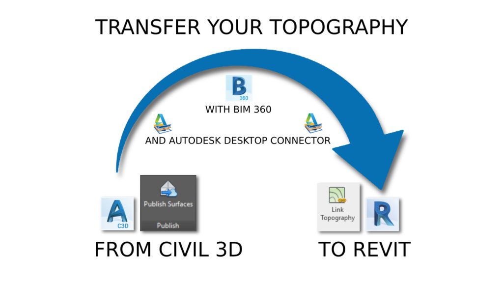
This is kind of a big deal. Site collaboration introduces unprecedented interoperability between Revit and Civil 3D New workflows and will save time and improve accuracy when you are transferring site information and project location data between project teams. You can easily link topography from Civil 3D into Revit using Autodesk Desktop Connector and BIM 360 Docs and will also be able to interact with this topography in Revit with surface hosting, tagging and scheduling. Civil 3D is included in the Autodesk Architecture, Engineering, and Construction Collection, which is also a great way to access Revit along with other essential tools at a great value.

Civil 3D Publish to Revit:
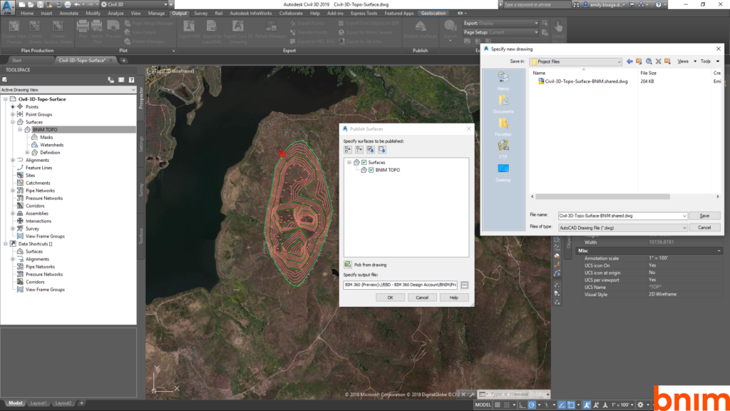
The site collaboration feature connects architects using Revit and engineers using Civil 3D via the BIM 360 document management module. When publishing Civil 3D to Revit, the workflow focuses on topography only. Engineers in Civil 3D can publish topography from Civil 3D, view the resulting data in BIM 360 document management, and then link the published data into Revit. Here’s how it works:
- In Civil 3D, from the tool space, select the surface for publish via Desktop Connector.
- Use BIM 360 to check the topography in a 3D view and verify the correct data has published from Civil 3D.
- You’ll need to use the latest version of the free Desktop Connector to publish to Civil 3D surfaces for synchronizing the local files in BIM 360 Document Management.

Revit publish from Civil 3D:
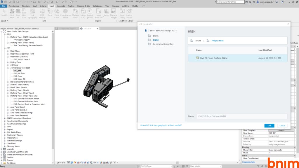
In Revit, you can easily link topography, which will help you to collaborate more effectively with civil engineers on the project.
- Browse to BIM 360 and link to the Civil 3D export.
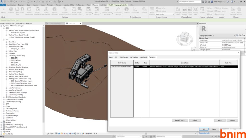
- Civil 3D geolocation will try to place the model appropriately in Revit, but you also have the option to specify coordinates from Revit to update.
- It is possible to spot dimension, add a building pad on the topography link, and create a topography schedule in Revit with name, projected area, and surface area.
This workflow also supports subregions and hosting railings. Subregions are good for changing the surface material in Revit. It is also possible to place elements on the topography – this will function as a link. Updates must be made in Civil 3D and edited and published again for use in Revit. To work best, this workflow will require a strategy for efficient navigation and linking. We recommend developing your BIM execution plan accordingly.

Making updates to the topography:
This enhancement vastly improves the workflow for topography transfer from civil engineers to architects. You can make changes in Civil 3D and then upload as described in the previous process to BIM 360. In Revit, use “reload” or “reload from” and link the topography again.

Learn about all the new features in Revit 2019.1
2. Enhanced performance
As you take the newest version of Civil 3D for a spin, you’ll experience notable improvements to production efficiency. We hope these upgrades will help drive quality and make workflows more efficient as your projects grow in scale.
For example, now you can create a data shortcut to a sample line group and then reference only a subset of the sample lines into a consumer drawing. The entire data reference framework is more efficient, synchronizing references only when the referenced object itself changed. Learn more about creating sample line group references.
When you are modeling a gravity pipe network, you can now connect pipes to structures that support multiple connection points. Civil 3D 2019.1 includes a variety of new structures that have multiple connection points, and you can add multiple connection points to your custom structures using the Infrastructure Parts Editor.
We also included a number of other enhancements to make designing your projects more efficient. From enhancements to the best fit and profile layout tools to resolutions to known issues, Civil 3D 2019.1 is a significant step forward.
3. Best Fit alignment for complex geometry
Civil 3D allows you to create a best fit horizontal alignment utilizing blocks, feature lines, or COGO points. The best fit alignment tool supports complex curve geometry and several types of transition spirals. With this tool, Civil 3D is able to quickly perform a regression analysis to create a center line alignment. You can then evaluate the results of this analysis and adjust the alignment as needed. You can also create a best fit profile based on blocks, feature lines, COGO points for surfaces. Civil 3D gives you the option to create a profile above or below existing grade. Once the profile is created, you can adjust the vertical curves as needed to optimize your design.
4. Just for rail workflows
We’ve made several improvements to enhance the workflow for rail projects, including:
- Adding a dedicated rail tools tab to consolidate rail-specific tools and rail options on relevant contextual tabs.
- New rail subassemblies including single, dual, multiple-track and single and dual platforms. These subassemblies allow for the design of track and platforms off of a rail centerline alignment and cater for CANT.
- LandXML CANT support for alignments allows users to exchanged rail alignment geometry with other design tools.
- Rail CANT support allows users to use the powerful offset alignment to design dual track scenarios.
- Improved alignment interchange with InfraWorks. All spiral types can now be interchanged between the two products.
Join us live in our bi-weekly community webcast. On August 22nd, we’ll demo the latest features of Civil 2019. And on September 5th, the Revit team will showcase the interoperability features of Civil 3D and Revit. Stay tuned for more details!