Estimated Reading Time: 4 Minutes
A rapidly growing population, resource constraints, and an urgent need for climate-resilient infrastructure… civil engineers and architects face a host of challenges as we approach the next decade.
But what if you had to build a city for 600,000 in less than six months right now?

At a time when countries worldwide face unprecedented migration crises, this is the kind of challenge that’s already a reality for the UN Refugee Agency, UNHCR, in Bangladesh.
The country is in a state of emergency due to the many Rohingya, mostly women and children, who came to seek protection from violence and persecution. Most of the refugees arrived within three months of the crisis, putting enormous strain on Bangladesh’s resources.
To make sure they had access to shelter, clean water, and sanitation, UNHCR needed to establish a settlement—the largest of its kind in the world—fast.Architect and site planner, Phoebe Goodwin, and her team met the challenge head-on with the help of Civil 3D and InfraWorks software.

Site planning in crisis situations involves determining where to put shelters, emergency latrines, roads, footpaths, bridges, and access. “It is an exercise in town planning,” says Goodwin. UNHCR also has to build camps to last. The average refugee camp remains active for 17 to 20 years, as most of the world’s refugees can’t return home for decades.

Planning in crisis with Civil 3D
To plan a site that would safely house hundreds of thousands of people, Goodwin and team turned to Civil 3D. From planning to design, Civil 3D’s plan production tools provided the construction documents she needed.
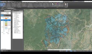
As if planning a 600,000-person community in less than six months wasn’t enough of a challenge, UNHCR had to ramp up production to prepare for monsoon season. UNHCR received an expansion area of about 800 acres to use for a contingency plan. Civil 3D’s geospatial data and visualization features helped Goodwin plan for massive landslides and floods. “I can take contour maps and I can see, for example, a flood-prone area analysis,” she says.
“We’re basing a lot of our pre-monsoon contingency planning on this analysis. We can determine the approximate number of households that may be affected by flooding and who we need to prioritize for pre-monsoon relocations to higher ground.”
Microdesk senior consultant, Jessica Chambers, who trains UNHCR staff on Civil 3D, says the software helped site planners more easily adapt to the ever-changing camp conditions. “It really highlights the need to use data effectively; so the tools we’re developing and going to implement use as much information as possible to inform design within the software,” she adds.

“That includes GIS information, any type of analysis that’s been done in the past to overlay on their plans, gathering topography, and analyzing the surface. Showing site planners they can pull that analysis out and show steep slopes—that is going to be essential at this site to prioritize what needs to be moved first on the steepest, least stable slopes.”
Civil 3D features that tackle tomorrow’s challenges
Even in non-crisis mode, these Civil 3D features can help civil engineers build tomorrow’s infrastructure today:
- Effective use of simulations, visualizations, and water analysis tools to improve communication, project delivery, and decision-making.
- Design to build: Seamless end-to-end processes when handing over site data to architects and design data to the construction team.
- Connect design processes to the cloud: Using Autodesk BIM to capture existing design information and import it to Civil 3D for enhanced design, teams around the globe can access information, enhancing efficiency.
During a refugee crisis, no site plan ever becomes a concrete blueprint, Goodwin said. Civil 3D gives her the flexibility needed for a dynamic, ambitious project that brings a better quality of life—most likely for years—to hundreds of thousands of people.
Let’s tackle the world’s design challenges together. Learn more about Civil 3D.