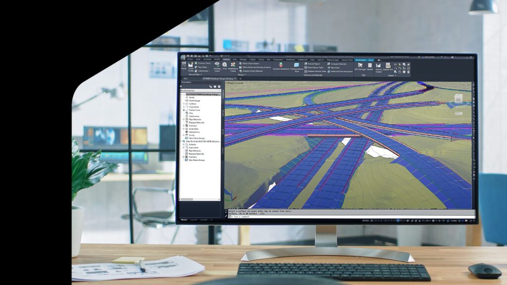
An integral part of roadway design projects is the creation of alignments, which define the horizontal and vertical layout of roads.
Autodesk Civil 3D provides powerful tools for designing alignments with precision and flexibility. See how EMAY Engineering relies on Civil 3D for large-scale roadway projects to help maximize design efficiency.
This second installment in the series of how to design roadways in Civil 3D explores how to create and edit roadway alignments, including offset alignments.
Optimize roadway design with multiple options for creating alignments
Civil 3D offers a few methods for creating alignments. To create roads with S-curves (or reverse curves), designers can lay out tangent sections where the two opposite curves meet by drawing a tangent between the beginning point and the first point of intersection.
Enter the first curve as a floating curve by selecting any point on the tangent, specifying the radius, then selecting a through point that it must pass through. Add a second curve as a free curve, specify it as a reverse curve, and adjust the geometry of the S-curved road as needed.
Designers can modify the geometry by moving the grips. The reverse curve will stay true, which offers flexibility if anything on the alignment needs to change.
Reduce errors with flexible alignment creation
Team members can also create alignments from existing linework. First, orient the drawn line so that it integrates with existing layouts. Roadway design projects typically intersect immovable infrastructure, making accuracy paramount to avoid costly conflicts.
Starting at an intersection, move down the line, drawing polyline points at each intersection. Run the Fillet command at each curve to smooth transitions between intersecting lines.
Use the “Create alignment from objects” function to convert the oriented polyline into an alignment, specifying the stationing direction and criteria such as design speed at a given station.
To import alignments, open the Insert tab and choose LandXML, which supports superelevation and lets designers choose which elements to import.
Translate roadway complexity into accurate design
To increase curvature of a road, add spirals by choosing the “free spiral-curve-spiral” function in the Alignment Layout Tools menu. Next, lay out the curve by selecting tangents and specifying the radius. Finally, indicate spiral lengths on both sides of the curve. This is just one way to edit road curvature – join the Autodesk professional community to find out more.
Other useful features include the Subassembly Composer add-on for constructing multi-element road structures and the Dynamo for Civil 3D tool for custom scripts to automate workflows. Both have benefited EMAY’s design efficiency in multi-kilometer road projects where teams have to deal with complex networks of infrastructures, according to Burcu Kaba, Transportation Engineering Group Manager at EMAY.
Once designers create alignments, they can easily edit simple geometry like curves, points, or tangents using the grips or tools. They can update stationing in the Alignment Properties menu, while the Alignment Grid view provides detailed geometries and allows for precise modifications according to design criteria.
Finetune design precision using offset alignments
Offset alignments are essential for defining features like additional lanes and corridors. For example, if designers need to plot a turn lane that crosses an existing alignment, they can create an offset alignment to govern assemblies such as shoulders and barriers.
Simply select “Create alignment offset,” base it on the alignment being crossed, define offset alignment details, ensure correct stationing direction, and set properties. You can create profiles with specified offset slopes as needed.
Learn More
Civil 3D’s alignment tools are vital for precise roadway design. They offer flexibility and adaptability to existing road infrastructure. Learn more about Road and Highway Design using Civil 3D as part of the AEC Collection.
Watch the video: Back to Basics Pt. 2: Roadway Design in Civil 3D – Roadway Alignments
Plus, stay tuned for the next part of our series, which will explore roadway profile creation.
Want to catch up on part 1 of our essential learning series? Learn How to Design Roadways in Civil 3D, Part 1: Gathering GIS Data and Creating Surfaces.
