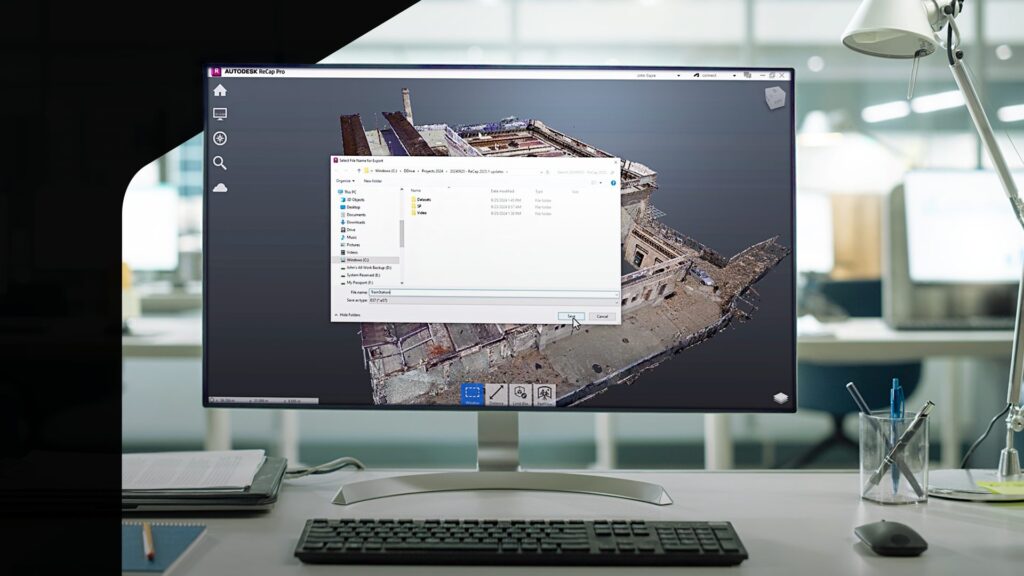
As technology evolves, so does the need for more precise and flexible tools for designers and civil engineers. Autodesk ReCap Pro 2025.1 brings a host of new features and improvements that provide you with improved accuracy, better visualization options, industry file format interoperability, and increased navigational flexibility. Here is a detailed look at what’s new in this release.
Seamlessly convert E57 panoramic images to RealViews
ReCap Pro 2025.1 supports the ability to import panoramic images from E57 and LAS1.4 files. With this release, you can now create a RealView with the original image quality by using panoramic image data during import.
Now you can import and view these panoramic images as RealViews, aligned with the point cloud data. This enhancement will allow you to share existing conditions across teams anytime, anywhere throughout the full project lifecycle, enabling a more accurate and high-quality visualization of your projects.
Easily export E57 panoramic images
ReCap Pro 2025.1 delivers a new way of enabling all critical modifications to stay in your E57 files for structured projects.
Rather than having to redo work to ensure all the latest edits are in the files, ReCap Pro 2025.1 allows you the ability to import structured scans from various supported scanners, perform necessary edits, and then export the entire project as a single E57 file with all the panoramic images included. This feature enables a smoother workflow, as the exported E57 can be reimported into ReCap Pro, maintaining all the modifications across your project lifecycle. With this enhancement, no information is left out and teams can leverage the latest information for critical decision-making, which could help save time and money.
Save time navigating point cloud models with 3D mouse support
One highly requested feature that makes its debut in ReCap Pro 2025.1 is the support for 3D Connexion’s SpaceMouse for Point Cloud Navigation. You can now navigate the point cloud in the main 3D View for both Orthographic and Perspective views using a 3D mouse. This addition enhances the flexibility and control you have when exploring detailed areas of their point cloud models.
The SpaceMouse allows for smoother orbiting, zooming, panning, and flying around the point cloud, making it easier to navigate complex models and view key information faster than before. This feature is particularly useful when you want to use a regular mouse for editing operations while using the 3D mouse for navigation, providing a more efficient and intuitive workflow. Ultimately, reducing workflow time and enhancing user performance.
There’s more: ReCap Viewer updates
The ReCap Pro 2025.1 release also brings improvements to the accuracy and rendering of point cloud data in ReCap Viewer.
- ReCap Viewer now offers more precise measurements and consistent coordinates across both cloud and desktop, allowing you to work with accurate digital models throughout the full project lifecycle.
- Improvements in rendering of point cloud data in ReCap Viewer now provides a deeper level of visualization into key dataset details and helps teams gain critical insights to reduce errors and streamline workflow
Thank you for your continuous feedback! Tell us what you think of the latest updates and what other improvements you would like to see. Don’t forget to check out the Reality Solutions Roadmap to stay up to date with what’s coming.
Partner Spotlight: Case Technologies and Autodesk partner to preserve history in Volterra, Italy
For nearly a decade, the Volterra Detroit Foundation, with the support of Case Technologies and Autodesk, has hosted an annual digital preservation workshop in Volterra, Italy. By bringing together practitioners and technology partners specializing in reality capture, the Workshop seeks to preserve Volterra’s historical and cultural treasures.
In this time-lapse video, Case Technologies’ Director of Services Mark Dietrick, who serves also on the board of the Foundation and is a key facilitator of the Workshop, guides us through a typical digital preservation project for the Chiesa San Giusto, a nearly 500 year old structure still in use for religious services today.
Through the use of laser scanners, radar, drones, and traditional in situ research, the Foundation is using the technologies of today to unlock a deeper understanding of the past and preserve it for future generations.
See highlights from the 2024 workshop @ Autodesk Building Solutions on YouTube.
Join us for the BIM and GIS for Infrastructure and Buildings webinar
Learn how Autodesk, in partnership with ESRI, is connecting the BIM and GIS workflow to integrate geographic data into design and engineering projects for a more complete understanding of existing conditions and project context.
Join the upcoming webinar on Wednesday, October 9, 2024 and see the latest workflows supporting Scan to BIM to GIS to improve your decision-making and modeling of design intent, resulting in better outcomes for your clients. Register now!
Together, let’s make the future at AU 2024
AU 2024 offers hundreds of courses from leading practitioners and thought leaders in the AEC industry. Learn about new and evolving capabilities for reality capture offered by Autodesk and get tips and tutorials for improving your workflows.
Join us in person or livestream sessions from the comfort of your desk.
October 15 – 17 | San Diego
More ReCap Resources
ReCap Pro Release Notes
Read the full release notes in the ReCap Pro – Product Help.
ReCap Public Roadmap
Looking for what’s new and what’s next for ReCap features and capabilities? Check out the ReCap Public Roadmap.
ReCap Forum
Have a question about ReCap? Take it to the ReCap Forum and let the community of ReCap users help you sort it out.
ReCap Ideas
Have an idea for making ReCap better? Go to ReCap Ideas to find, post, and vote for the things you want to see in new versions of ReCap.