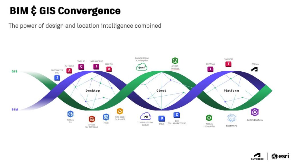
Data silos? What data silos? That’s the new reality with BIM and GIS together. Since Autodesk and Esri joined forces, owners and AEC design teams have discovered incredible new efficiencies and workflows—all with data at the center.
At the start of the alliance, we connected BIM and GIS at the desktop level with the Autodesk Connectors for ArcGIS. Since then, we’ve collaborated to establish cloud-to-cloud connectivity with Autodesk Construction Cloud and Esri’s ArcGIS. We’re also collaborating to further the integrations to include access to Esri Basemaps in AutoCAD and integration of GIS into Forma.

AU 2024 was a prime opportunity to dig deeper and learn about real-world learnings implementations of BIM and GIS being done today. But those insights weren’t siloed in San Diego either. We have many of them free and on demand. Here’s a sampling to get you started!
Design on Location: Exploring the Integration of GIS and BIM
Watch on demand
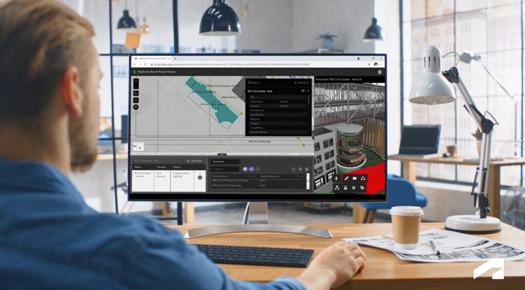
Jeff Frye, Western Region Digital Delivery Lead at HDR, and Michael Davidson of Esri highlight how BIM-GIS integrations benefit many roles across project phases. Gain insights into establishing initiatives at your organization that bring GIS and design teams together for cross-team collaborations. See how designers use Civil 3D software to discover ArcGIS data that contextualizes sites and informs decisions. Finally, learn ways that project managers link documents from Autodesk Construction Cloud to GIS web features and coordinate across teams on resolving site issues. Get ready to harness BIM-GIS integrations for both your benefit and other teams in your organization.
GeoBIM in Action with ACC: A Common Data Environment for Integrating BIM and GIS in Infrastructure Projects
Watch on demand
Autodesk’s Vince Fredon and Daniel Moral join Juan Camilo Valdes, a civil engineer and National Projects BIM Manager for HEB, to explore the dynamic integration of ArcGIS GeoBIM with Autodesk Construction Cloud. See how geographical data and the latest intelligent models are synchronized seamlessly and discover how to use these integrations for improved project visualization, GIS data integrated with intelligent models, and site management. Uncover new insights on integrating GIS information with construction data, optimizing issue resolution, and facilitating smoother transitions between project stages.
GIS and BIM for Architecture, Urban Design, and Planning
Watch on demand
Clay Starr, Architecture, Urban Planning & Design Lead at Esri, explores the design process where BIM and GIS create a foundation for more socially, environmentally, and economically just environments—where today’s technologies create a better tomorrow. Learn about the current pain points in the design process, including existing conditions, data interoperability, and handover. Discover the role of GIS in design, its contribution to developing effective delivery strategies tailored to desired outcomes, and more.
Integration of BIM and Hydraulic Modeling into a Single Workflow
Watch on demand
The development of information flows in each phase of asset life enables integration and interoperability between design applications (Civil 3D or InfraWorks software), geographic information systems (ArcGIS), and hydraulic modeling software (InfoWorks WS PRO software). Paulo Macedo of FF Solutions shares insights on network pathways, sizing, depth, clash detection, documentation, calibration, operational rules, and more by using the best application for each step with the smoothest interoperability.

Toward Safe and Inclusive Urban Landscapes: Bringing BIM and GIS Together
Watch on demand
As urban areas expand, the challenge is clear: evolve into sustainable and inclusive environments or risk growing disparities and instability. Many of the challenges are inherently spatial, so it’s important to first understand their immediate surroundings to deliver new solutions. Urban and infrastructure projects should be able to collect and manage data to identify needs and prioritize them. Olivia Melazzo, Project Developer at /slantis, details how to implement GIS interoperability with BIM in early-stage planning to create inclusive and welcoming cities.
Megatunnels You’ve Never Heard of: Data-Driven Strategies for Infrastructure Owners
Watch on demand
Traditional approaches like DBFM procurement and sequential design and construction prove inadequate for monumental, billion-dollar projects. Yanissa De Jonghe and Bas van Eekelen of Lantis and Autodesk’s Guillaume Neyrinck share the results from a pilot partnership with Autodesk and Esri, showcasing the Infrastructure Asset Management 5.0 journey. Learn about the benefits of cloud-based collaboration and BIM not for only design and how owners can use the power of dashboards to strive for zero unplanned infrastructure downtime.
Breaking Down Barriers: A BIM-to-GIS Workflow Toward an Integrated City Model
Watch on demand
Mohyeddine Al-Khatib, Vijaya Venkata, and Ahmad Zaiour of Khatib & Alami explore the boundless potential of integrating BIM and GIS. Gain invaluable insights into optimizing workflows and the numerous use cases once the floodgates of data interoperability are open. Discover the best strategies to use the combined power of BIM for buildings and infrastructures and GIS for districts and cities.
Discover even more!
Hundreds of AECO classes are available on demand. Check out the full catalog to learn more!