& Construction

Integrated BIM tools, including Revit, AutoCAD, and Civil 3D
& Manufacturing

Professional CAD/CAM tools built on Inventor and AutoCAD
4 min read
Recently, Innovyze hosted a live demonstration of the latest features and functionality within Info360 Asset, our web-based platform for water utilities and consulting firms to use to manage asset inspections and conduct condition assessments, as well as to develop risk models for the prioritization of capital improvements. During the last couple months, we’ve continued our rapid innovation on the platform, with a primary focus on ensuring the risk-modeling capabilities are even more robust to support new use-cases and refine workflow.
Visualizing asset condition and risk data on a map, and in context to other spatial data, is critical to decision-making. When risk modeling, don’t you want more control over the visuals? With the latest web mapping enhancements, you can take your risk modeling development to a whole new level:
New spatial layers can be added for the purpose of risk analysis can also be configured in this way for visualization on the map. Not only that, but you can easily share these customizable web maps with stakeholders and decision-makers.
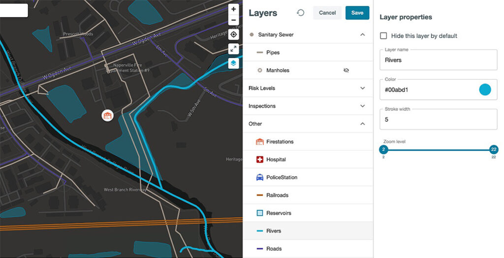
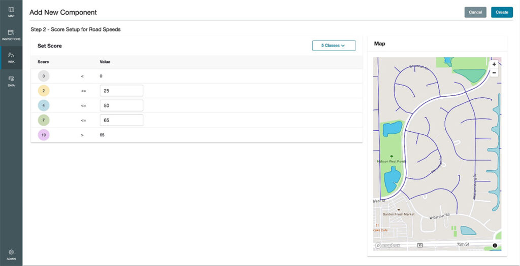
Spatial proximity is a key input when building a robust risk model. Within the Info360 Asset platform, not only can you set up a risk model component by comparing the distance from an object (e.g., road, river, hospital) to an asset before creating a scaled scoring system using distance ranges, you can break out risk scores by attributes contained within a spatial layer.
This includes scoring roads by class, traffic patterns, when a road was last paved, or the road’s speed limit. Almost all risk models have an element of spatial context to them. However, the differentiator within this tool is the capability to build highly customizable risk models that represent all risk factors.
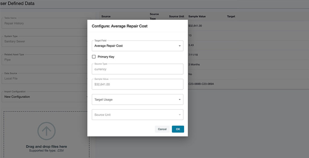
Historical information matters. We understand that continuously updated data is vital for your risk model, but it’s essential to store historical data as well, especially when it comes to risk modeling for your asset. In the spirit of that, you now have the ability to bring tabular data into the program and associate it with your desired assets to use for your risk model.
User-defined tables can be imported and linked to the assets based on a common identifier. With this feature, you can extend the asset data schema beyond what is provided in the basic application, to include the sample date of the most recent repair, average repair costs, or the count of service requests.
A key benefit of Info360 Asset is the capability to build LoF and CoF risk models in a clear, visual manner to understand your business risk exposure better. You and your team can easily input manhole inspections, verify them against the standard, and generate condition scores.
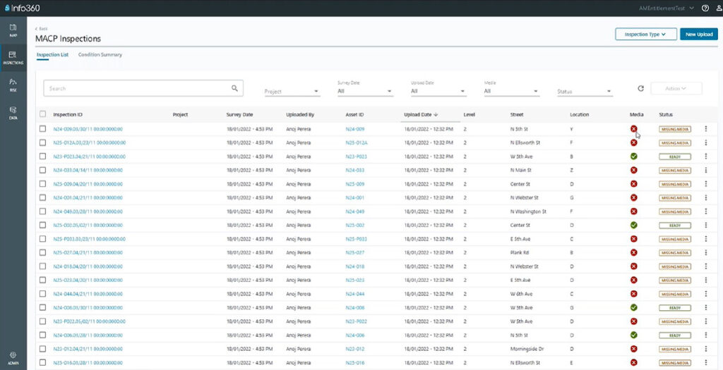
Once approved, manhole inspections are associated to the correct manhole asset and are published on the map. Overall, structural and service ratings, as well as the individual component condition scores, are calculated automatically according to the industry standard. The condition ratings are published for each manhole in the condition summary table which can be sorted and filtered.
Why is this so crucial? Because manhole inspections need standardization to be compared to other systems during assessment. Processing data (e.g., CCTV surveys and manhole inspection) is now even more streamlined within the platform. The advancements have been specifically designed to handle large amounts of asset condition data from various sources. These changes provide even more investment value to your team, as these inspections are used for a variety of purposes.
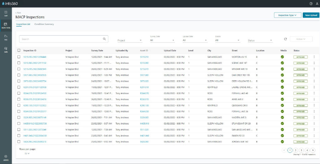
Thanks to centralized asset data and information management in the cloud, any member of your team can access condition data, and the relevant media, from anywhere at any time. However, sometimes you just want to get started quickly and get your risk model and associated rehabilitation plan built. In the past, in order for condition data to be used within the risk model, media files had to be uploaded first. We know that this could be a roadblock for getting started in the product when migrating a very large historical database of inspections to the platform.
After working with many customers on this unique challenge, we’ve come up with a solution. Now, with our latest version of Info360 Asset, you can approve inspections and continue work on the risk model with or without media files uploaded yet. Your pipeline and manhole inspections dashboards will simply indicate whether or not media for an inspection has been uploaded into the system. With these improvements, your team can complete your risk model and get inspections approved even quicker.
If you’re excited to try out these new features, or just want to know more, hear about all of the details of this update in our most recent Water Talk.
Sign up for the One Water Blog newsletter, and we'll keep you updated about our top stories, along with the best content we find online. We only send out a newsletter when we have something interesting to share.
May we collect and use your data?
Learn more about the Third Party Services we use and our Privacy Statement.May we collect and use your data to tailor your experience?
Explore the benefits of a customized experience by managing your privacy settings for this site or visit our Privacy Statement to learn more about your options.