Extending Bing Maps range to cover larger area in Map 3D or Civil 3D

Autodesk Support

Oct 8, 2023


Products and versions covered


Issue:

When Bing Maps Online Imagery is displayed in a drawing with a coordinate system assigned in Civil 3D or Map 3D, the map does not display all the data.
How to extend the map to cover a larger area?
 

Causes:

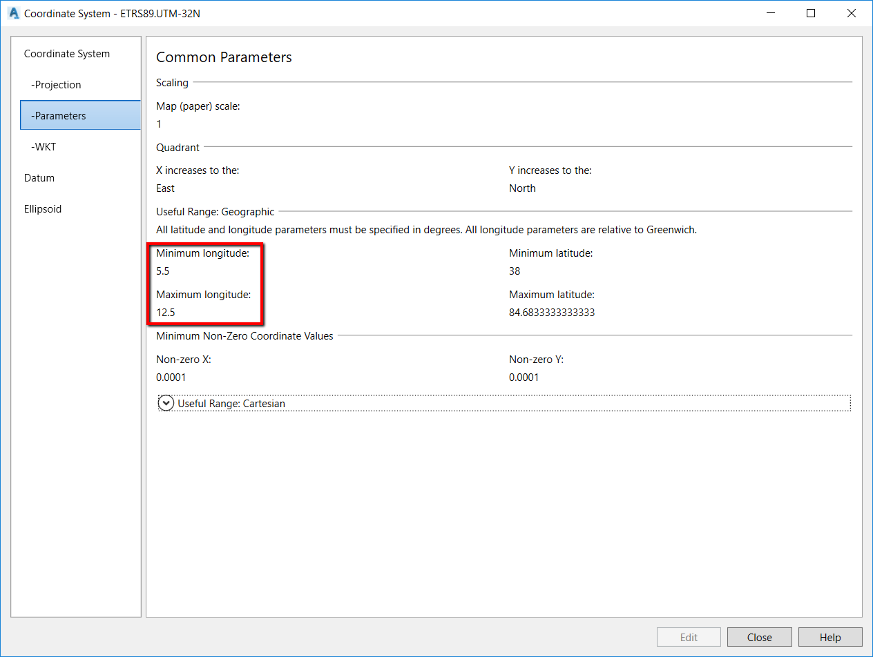
The useful range of the coordinate system is used to limit the display of data outside the defined range.

User-added image
 

Solution:

Extend the range of the Bing imagery: 
  1. Enter the MAPTRACKCS command on the command line.
  2. Note down the extent of the longitude and latitude coordinates.
  3. Enter the MAPCSLIBRARY command on the command line.
  4. Locate the coordinate system which only shows part of the Bing Maps and click Duplicate.
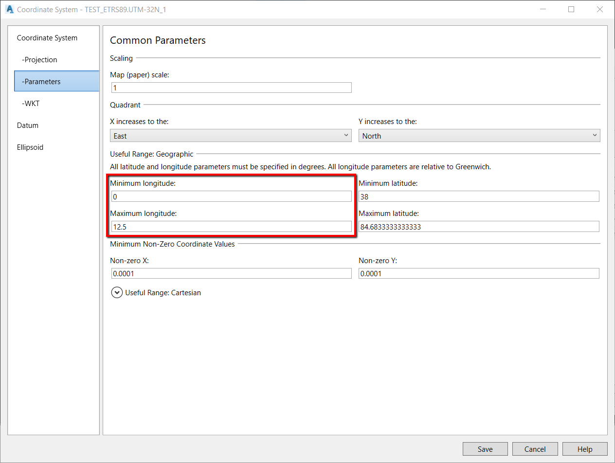
  5. Edit the duplicated coordinate system and in the Parameters tab, amend the useful range to a larger extent, for example:
User-added image
  1. Click Save and Assign.
  2. Restart AutoCAD Map 3D or Civil 3D to make the changes effective.

Products:

Civil 3D; AutoCAD Map 3D;


Was this information helpful?


Need help? Ask the Autodesk Assistant!

The Assistant can help you find answers or contact an agent.


What level of support do you have?

Different subscription plans provide distinct categories of support. Find out the level of support for your plan.

View levels of support